Overview
We conduct wind resource assessments, a critical step in determining the feasibility of wind power projects.
We propose optimal observation sites and equipment based on an analysis of meteorological data, topography, and vegetation surrounding the planned project area.
In complex terrain such as hills or mountains, we perform prior computer simulations using wind analysis software to evaluate local wind flow. This ensures the acquisition of high-quality data suitable for detailed analysis, including estimates of annual mean wind speed and turbulence intensity.
For offshore wind applications, we utilize Scanning LiDAR technology to remotely measure wind conditions up to 10 km offshore from land. We also offer "Dual Scanning LiDAR Measurement," employing two units simultaneously for enhanced precision.
During the measurement period, we download and archive measurement data daily. We also provide monthly and yearly data analysis reports upon request.
We propose and implement wind resource assessments that meet third-party certification standards. We provide end-to-end support, from site selection to Wind Farm (WF) certification conformance.
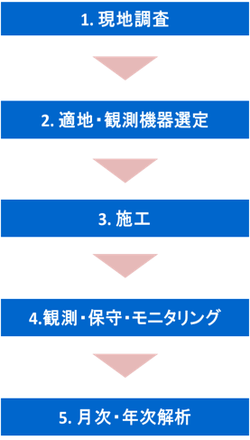
The flowchart of the wind resource assessment is shown on the left.
Examples of Observation Equipment
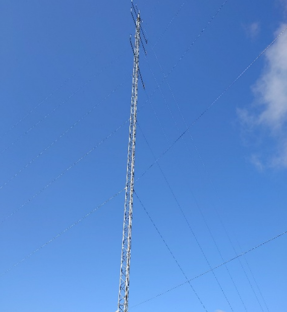
・Wind Measurement Mast (triangular lattice tower with four-guy wires)
We conduct measurements compliant with IEC 61400-12-1:2017 standards to support Wind Farm certification.
The standard mast height is 60m. We select and install appropriate wind speed and direction sensors, as well as sensors for measuring air density.
All sensors are calibrated by accredited testing laboratories in accordance with international standards (IECRE, MEASNET).
We also offer post-measurement calibration (wind tunnel testing) upon completion of the measurement campaign.
If land availability is restricted, we can install self-supporting measurement masts that do not require guy wires.
Wind Vane: Thies First Class;
Anemometer: Thies First Class
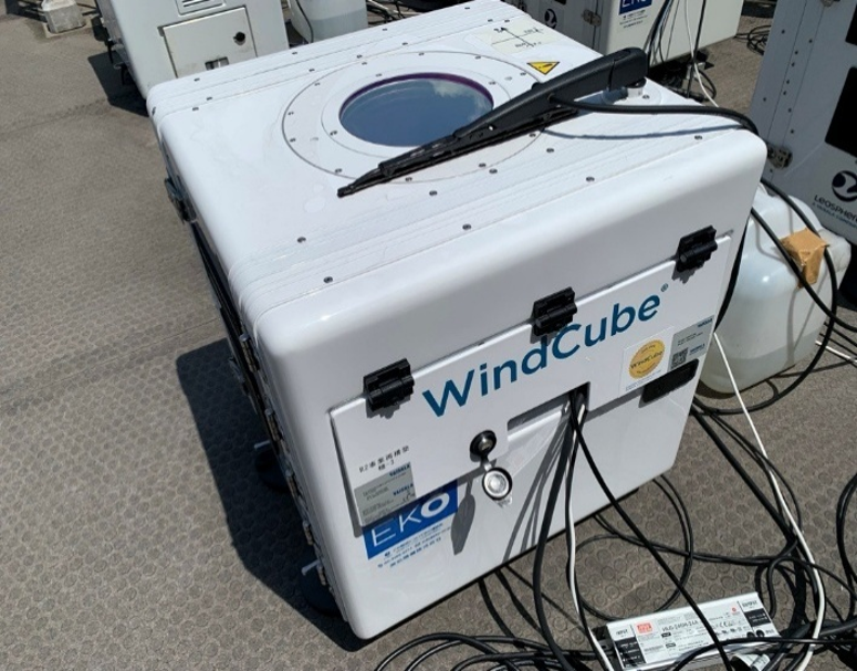
・Vertical LiDAR
Windcube 2.1
As wind turbines increase in size, site certification requires wind measurements at higher altitudes than conventional masts can reach.
We use LiDAR (Light Detection and Ranging) remote sensing technology to measure vertical wind profiles up to 300m above ground level.
For sites where AC power supply is unavailable, we can employ fuel cells.
・Scanning LiDAR
Windcube 100s/200s/400s"
For offshore applications, we employ the Dual Scanning LiDAR method, using two units to measure the same location, allowing for the measurement of turbulence intensity.
Please contact us(03) 6811-2515
Contact us by email